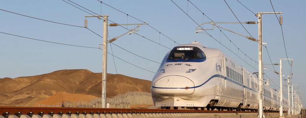
Railways to use hi-tech survey for high-speed train corridor
The railways will use LiDAR technology — which involves conducting an aerial survey, and is known to give accurate data on the contours of land, even below vegetation — to expedite work on India’s first high-speed train corridor between Mumbai and Ahmedabad.
The use of Light Detection and Ranging, or LiDAR, will allow the survey of the 508km corridor to be completed in 9-10 weeks against the normal 6-8 months. It will help the national transporter start ground work on the Modi government’s dream project by 2018. According to the plan, almost the entire corridor will be on an elevated track, except 21km that will be underground. Of the 21km, 7km will be undersea.
The survey will be conducted by a helicopter, which carries equipment, including a high-resolution digital camera (100 megapixel), a laser scanner and a data recorder. An official said LiDAR was a remote-sensing technology that measured distance by illuminating a target with a laser and analysing the reflected light. The GPS unit interacts with GPS satellites to finalise the ground control points.
“The total flying time for covering the full corridor will be 30 hours. The preparatory work and time taken in processing of data is quite high, but still the process allows the survey of the full 508km in 9-10 weeks instead of 6-8 months,” Mukul Mathur, executive director (PPP), railway board, said. The exercise is highly accurate and enables capturing data of buildings and forest,” Mathur said, adding that this technology would be used for the survey of a rail line for the first time. For the survey, the helicopter will fly at a height of 500 metres while identifying 15.6 points per square metre.
You might also like
Madhya Pradesh Tourism Board creates Land Bank to boost MP Tourism
Madhya Pradesh a state that reflects the true cultural heritage of the nation through the amalgamation of various communities, castes and ways of life has always been a major tourist attraction.
SriLankan Catering wins yet another Presidential Export Award
SriLankan Catering Limited (SLC) covered itself in more glory when it was named the winner of yet another Presidential Export Award, the third such award in recent years, as recognition
Ride with Ola and win a getaway to Mauritius from SOTC
SOTC Travel has joined hands with Ola, India’s leading and one of the world’s largest ride-sharing companies, to collaborate for a two-week contest from 20th July – 04th Aug, 2018 that will